

Gnar-ni-an
/nar-nee-an/
noun
Noun: Gnarnian; Plural Noun Gnarnians;
Adjective
Adjective: Gnarnian
- Relating to the characteristics of those who enjoy an adventurous lifestyle; those who live their lives on the edge
Root Word: Gnarly
- Difficult, dangerous or challenging.
When Zeke and Tyler invite you on somewhere with them—always, always say yes—that’s what I’m learning. Because, without a doubt, it will become an adventure. (and I can’t speak to their day-to-day routines, but I’m sensing the trend that anything these two guys touch becomes somewhat of a glorious tale.)
But let’s back up and give this story a little more context. Remember the night hike I told you about? Well this is somewhat of a sequel to that; with most of the same people and a different location.
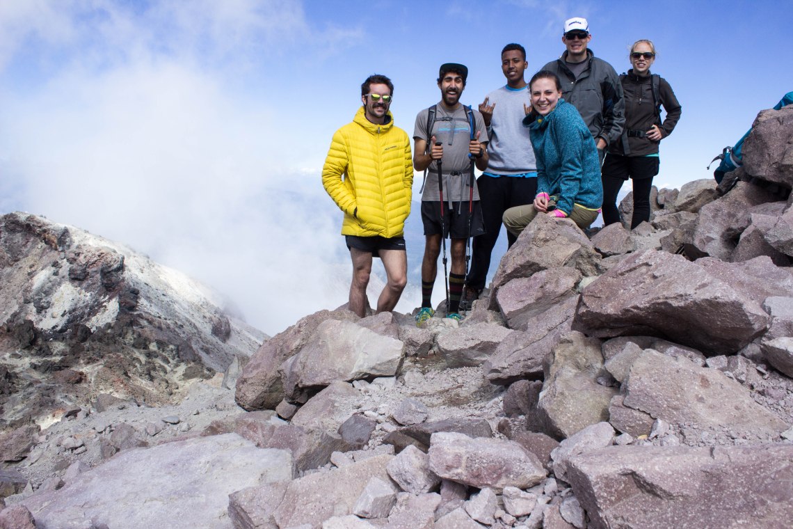
Beth and Ben are still a part, as are Tyler and Zeke (obviously) so we really just traded out Charlotte for Christian—an Ethiopian exchange student who landed with the staff for a home-leave.
So Ben and Beth were training to hike Mount Whitney—and since we had a break from school they decided to go to Lassen Volcanic National Park to practice with the elevation. All the girls in the dorm ended up going home or to friend’s houses, meaning I was free for the weekend. Christian was the only boy left from the boy’s dorm so the Beth and Ben just took him for the weekend, and we all ended up at Lassen for the weekend! Honestly I had never even heard of Lassen National Park before this trip, but it is now one of my favorite parks.
Anyway, all that aside, we drove the 5 hours over to Lassen on Friday, and spent the night at a campground right outside the park.
We set up camp and ended up talking around the camp fire for a few hours before going to bed.
Add campfire chats to my list of favorite things.
Saturday morning, we hiked up Mount Lassen. 2 ½ miles up and 2 ½ miles down. 10,000 feet and amazing views, but I can’t honestly say I loved hiking up (down was fabulous). Christian saw snow for the first time, and hiked a real mountain for the first time. Coming from Ethiopia, I’m sure he thinks we’re all crazy going outside all the time, especially to camp. In Ethiopia everything in nature will probably kill you. He said “no one goes camping in Ethiopia. Our whole lives are basically camping.”
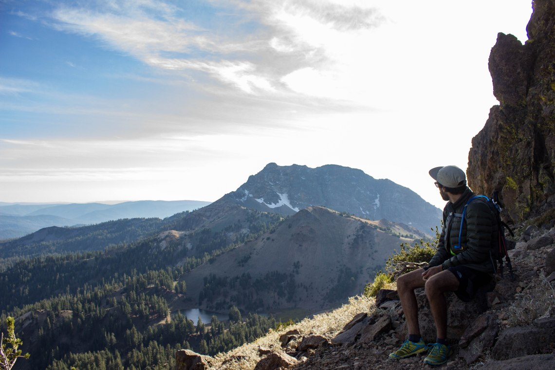
Once we were back at the bottom, Zeke and Tyler voiced this crazy theory—does the ridgeline between Lassen Peak and Brokeoff Mountain (the two largest mountains in the park) connect the two mountains in a hike-able way? They wanted see if it did. They asked if I would like to come, and I said yes. (secretly being a little afraid that they would be cruzing and I would be quickly dying—we’d already hiked 5 miles.) But I said yes anyway, and we set off for this gnarly adventure.
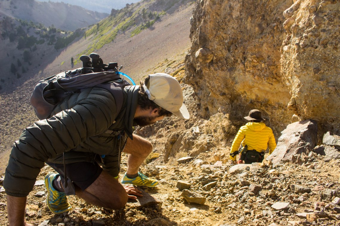
We immediately had to cross a small snow field that had been hiding in the crook of the mountain since last winter. Right past that there was a small trail that led us through a shallow valley and up to where the ridgeline started. We found the faint trail belonged to climbers; there were some bouldering rocks and a couple good walls to climb that we passed, as well as a couple climbers on the wall. Tyler and Zeke made plans to come back and try some bouldering.
Our next obstacle was a smaller mountain (okay, maybe it wasn’t exactly a mountain, but it was incredibly steep and composed of shale, making it slippery as heck to climb), and then from the top of it a clear shot at the ridgeline across. Zeke and Tyler had hiking poles, but I was struggling along with a camera in hand and a backpack that was unnecessarily heavy (my fault).
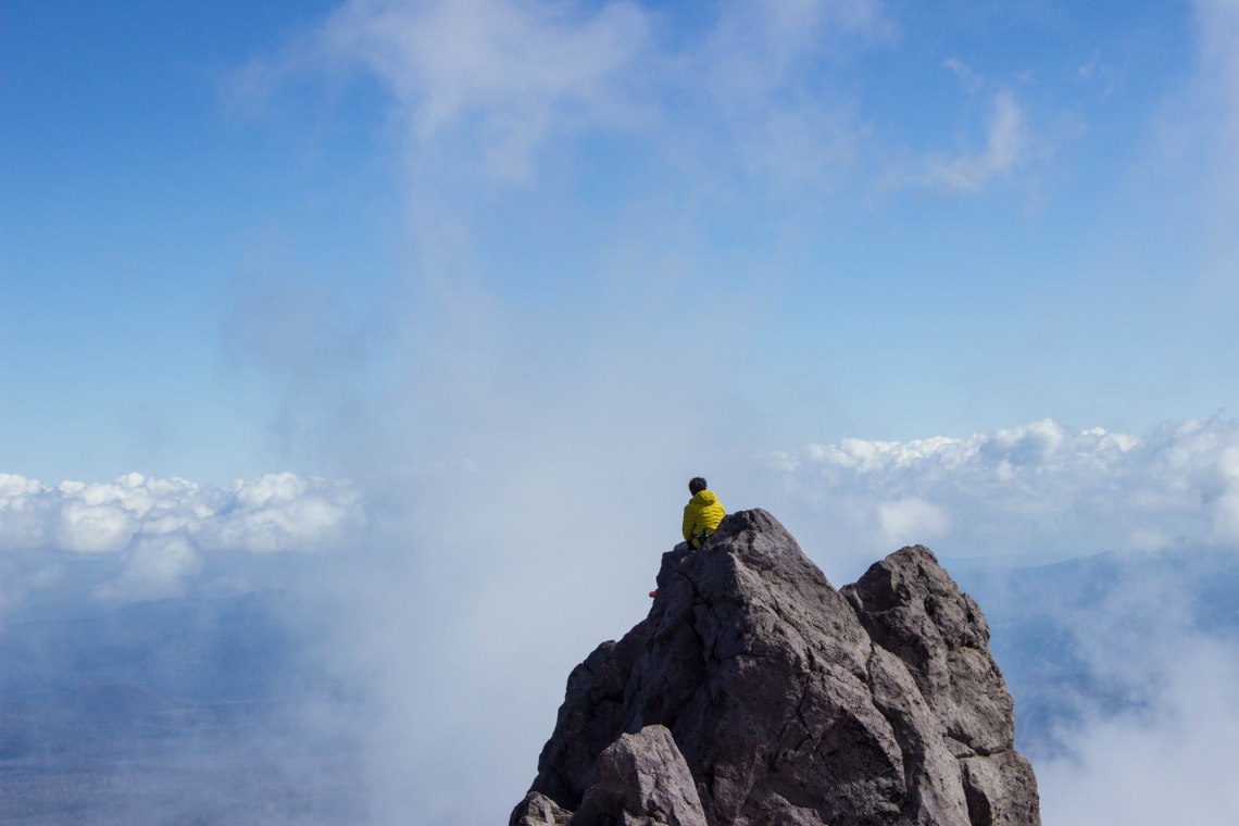
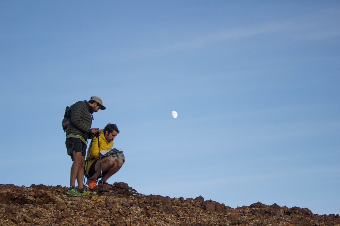
I reached the top a couple minutes after them, and tried to conceal my panting with a few strategic stops for photographs (another good reason to bring a camera along).
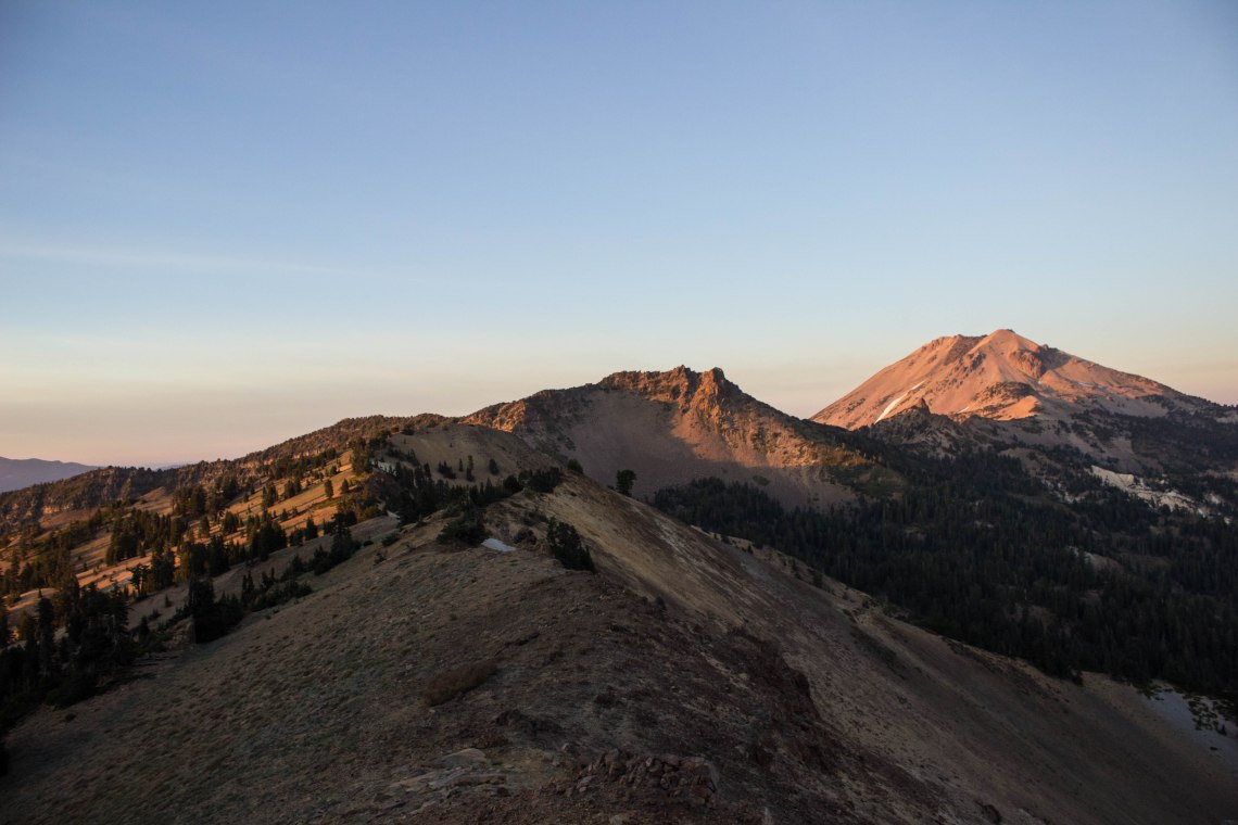
From that mountain, you can see Lassen, Brokeoff Mountain, and Mt. Shasta all in a 360 degree view. It was breathtaking.
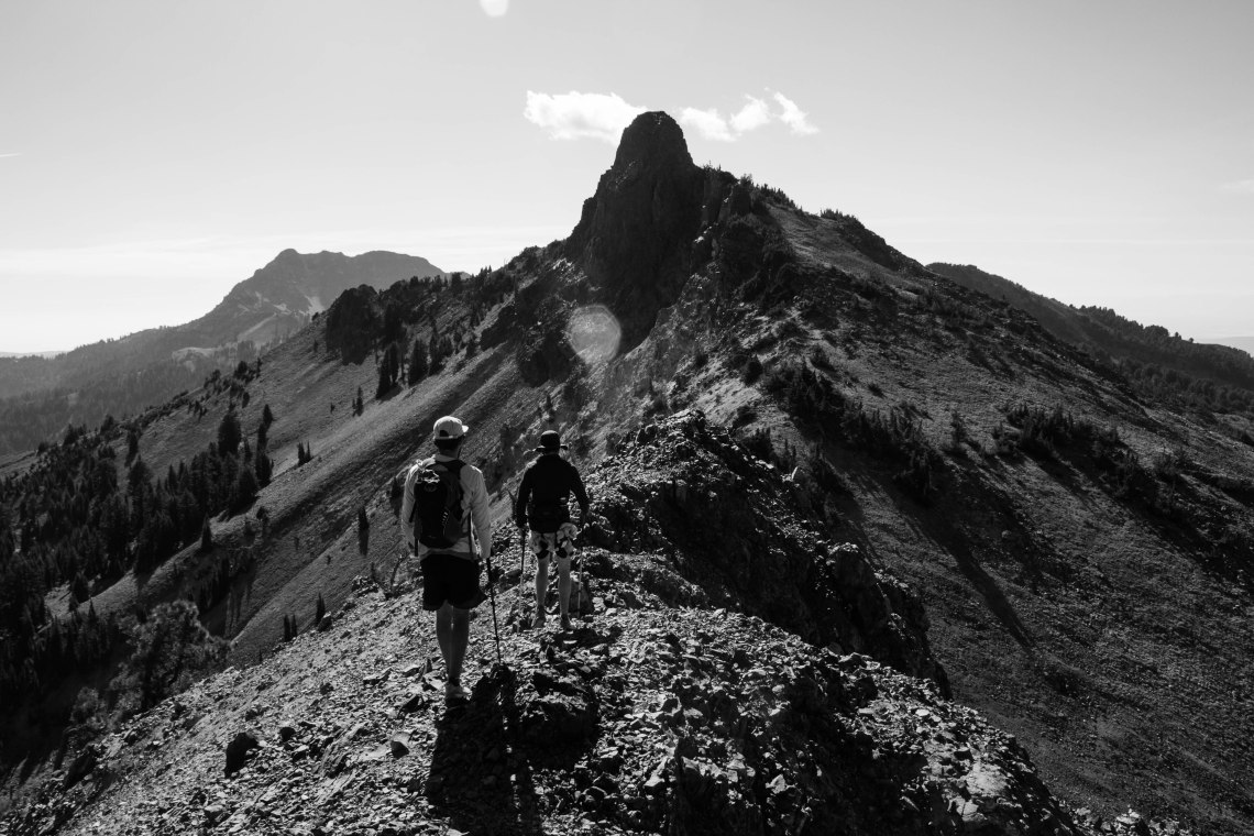
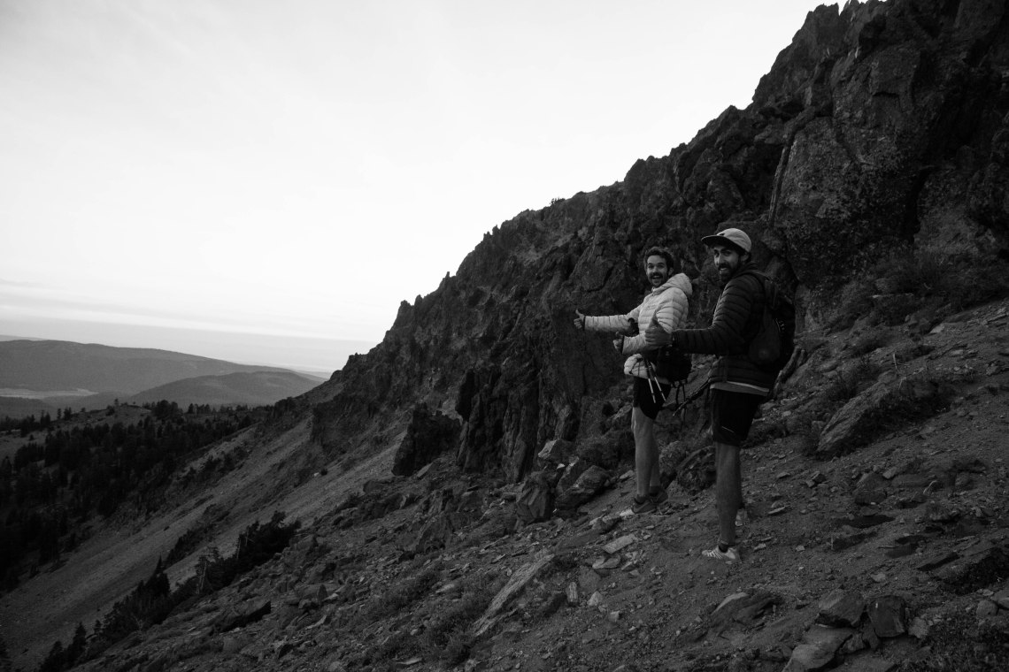
We hiked along the ridge line, and every time we thought that we would have to re-route, descend to a slightly lower altitude to pass over or around an outcropping or stony spire, something opened up and we just kept going. “She goes!” was the cry every time we found the route we needed, and that became somewhat of a mantra for the traverse.
As we hiked, the banter between Tyler and Zeke was honestly something to be jealous of. They can talk for hours about nothing at all and yet be having the best time of their lives. It’s a beautiful thing to see. We debated over what the christening name of the trail should be. We danced between the following:
“PFTT” – Pretty freakin’ tight Traverse
“PFD” – Pretty Freakin’ dead (while we were discussing what would happen if the volcano actually erupted while we were hiking. There was a zero percent chance of that happening, but we were curious just the same.)
“She Goes / She Sends” as that was said more than most words on the traverse
And some other names, bordering on the inappropriate side, that I will not to go into for all of our sake’s.

The trail just kept going. No matter what we always found a way. There were only a couple places where the trail was truly a little nerve wracking. A.) when the rocks dropped off to either side with small-ish (like 15 feet) cliffs on each side. B.) When we had to climb over and through rocks that kept breaking—especially when they were on the narrow cliff parts C.) When we had to slide down this little drop-off (it was probably about 10 feet of slanted sandy area, and a 6-7 foot drop at the end) where there was just stones and “scree” and every time you moved you would slide—and sliding meant falling off the little ledge. Zeke almost hit Tyler with a large stone as he slid down and I returned the favor by almost sending a large stone crashing onto Zeke as I tried to slide down. It all worked out though and no one got injured (yay).
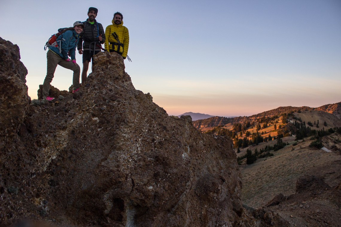
After the ledge section, we set out across this big bowl of small stones and plants. It was beautiful, as the sun was reaching the “golden hour”, but we kept sliding at a diagonal trajectory, as with each step more stone gave way under our feet. Our shoes filled with tiny stones and gravel, but we cut off a section of the ridgeline, and made it back to a small saddle on the other side, and set about climbing back up on the home stretch to Brokeoff.
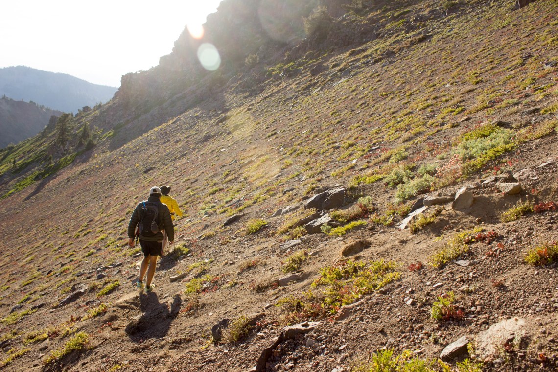
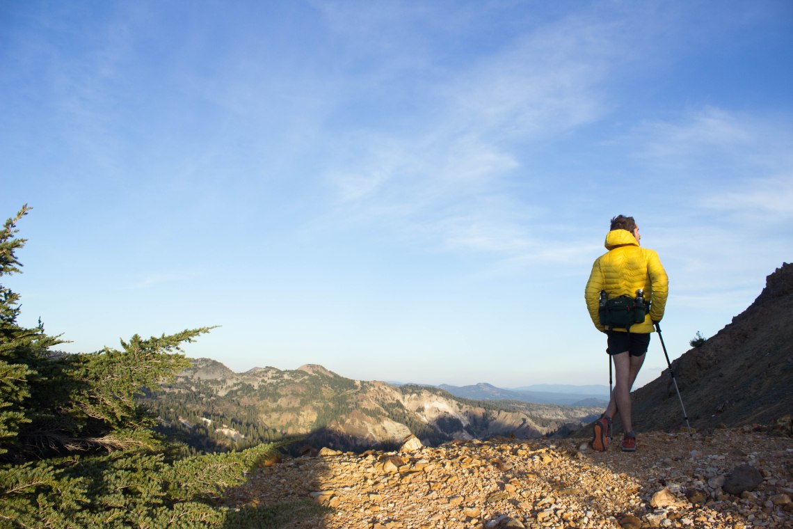
By the time we reached the ridgeline again, the wind was starting to whip over the edge of the ridge, making the temperature drop significantly. The saddle the ridgeline widened, and there was a meadow on the back side, making it a beautiful last mile (ish) of sunlight.
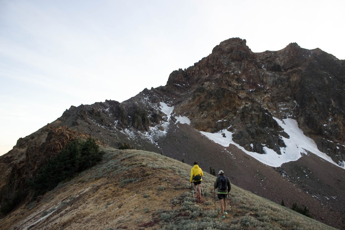
We made it to the bottom section of Brokeoff Mountain just as the sun was disappearing. The top half of the mountain jutted directly up from a field of broken stones and sharp boulders. We came to the base, where the boulder field met the stone spires, and decided to skirt the bottom of the mountain, and meet up with the trail on the back side. There were a couple more scary spots as we hugged the edge of the mountain to climb around to the boulder field. But we made it. It started to get dark, and walking through piles of jagged stones the size of baseballs, isn’t easy or quick going, so our pace slowed down. We spotted the trail below us. I’d guess it was a couple hundred vertical feet, but it was sloped, so that makes it harder to estimate. We realized that this would be the fastest way out, and so decided to just cut strait down to the bottom and follow the trail out from there, instead of meeting it on the back side of the mountain, as we had planned to do.
It was faster heading directly down, instead of fighting to not slide while walking parallel. Still, it took probably close to 30 minutes to bumble down. One small section was more sandy stone, and we could just surf/slide through it like riding on a tiny avalanche, and that took off a small but significant section of hiking.
We had to pull out our headlamps before reaching the bottom trail.
Honestly, the hike out on the trail took a long time. Or at least it seemed like a long time. I was just tired, my knees hurt from all the downhill we had hiked. It was dark and cold and the interesting beautiful part was over so it made hiking on a nice trail boring and tiring. I was glad when Zeke and Tyler said they were tired too. That made me feel better. Eventually we made it to the truck.
We had hiked 7 miles in (about) 6 hours, making the grand total of hiking for the day 12 miles. Those were some of the most beautiful 6 hours of my life.
We drove back to camp, and got some hot food, and sat by the fire for a while, warming up and talking about the day and life.
And that’s how I became a “Gnarnian”.


Very cool. Always enjoy hearing about your adventures.
LikeLike
That is so cool Courtney. You make me very jealous. But I’m not in any kind of shape to do that either. I’ll bet you have some awesome pics. Thanks for sharing!
LikeLike